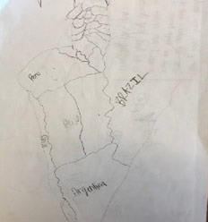
Early in the school year, Fourth, Fifth, and Sixth grade students are asked to draw a map of an assigned country or continent, with no help from textbooks or reference materials. The resulting products vaguely resemble their regions at best. Fourth grade takes on the United States, Fifth grade maps Europe, and Sixth grade tackles Latin America. Our Middle School students will continue this challenge with Seventh graders mapping Asia and Africa and Eighth graders mapping the world by heart!
Instant gratification is not the goal of Memory Mapping. Weekly study of borders, shapes, names, proportion and placement with the use of latitude and longitude are a part of our integrated curriculum. Mnemonic devices, discussion about shape and placement and a lot of practice drawing encourages success for students of all learning styles.


Proof of a greater understanding of geography is evidenced by the incremental success our students have demonstrated during the National Geography Bee. Since introducing Mapping by Heart to Andrews Academy Lake Saint Louis, the number of qualifying rounds at the Geo Bee have increased. This year in fact, we used all of the tie breakers and additional questions to identify the winner! For the past two years, we are proud to have had two students qualify to compete at the state level. This year, a sixth grader represented Andrews Academy Lake Saint Louis at the State National Geography Bee in Columbia, Missouri.
Dedicated teachers, determination, perseverance, and a positivity enable our students to accomplish a seemingly impossible task with pride and success. Beyond the obvious heightened understanding of geography, one of the greatest benefits of Memory Mapping is that our students are stretched to learn and to commit information to long term memory in order accomplish a goal through months of practice, study and work.